Google Earth Gallery
Google Earth is an alternative to GIS for quickly viewing caves and karst features and sharing information with others. KML and KMZ are the formats used to add data to Google Earth. You can create KML using Google Earth, Compass supports direct KML export of cave survey lineplots and passage wall models, and ArcGIS supports viewing and exporting KML files and publishing KML services. KML has been popularized by Google Earth and is now a ubiquitous format for geographic information.
Click the thumbnail to view a larger image. All maps and images by: B. W. Szukalski.
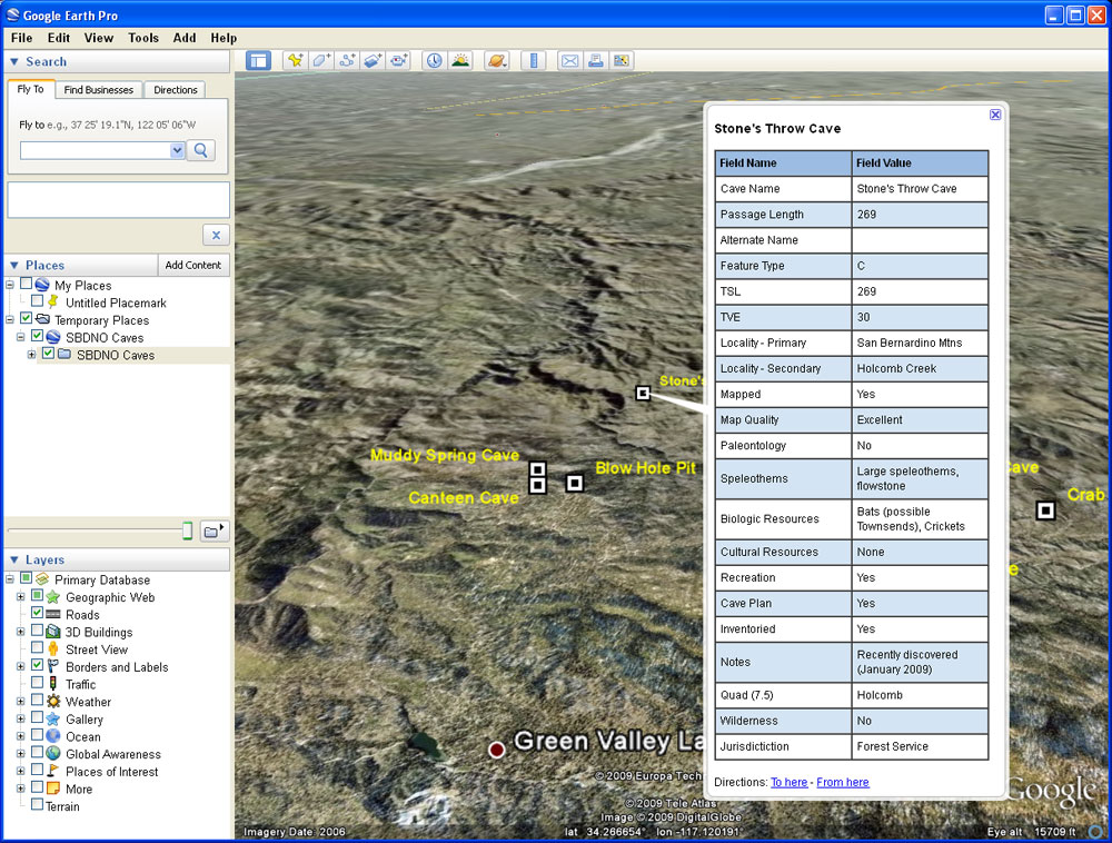
CAVE LOCATIONS IN GOOGLE EARTH
The KML seen here was created by exporting the cave location data using ArcGIS. Cave locations were added to ArcGIS by importing the exported contents of a spreadsheet containing GPS coordinates for each cave. The KML popup is the same as specified in the ArcGIS layer HTML popup properties, a new property tab on the layer properties introduced at the ArcGIS 9.3.1 release. Using layer properties the fields and field aliases can also be chosen for popup display.
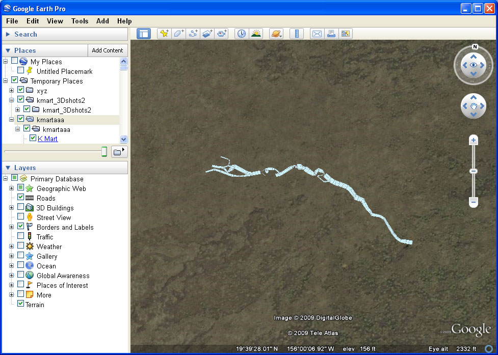
CAVE PASSAGE OUTLINES IN GOOGLE EARTH
The KML shown here was created by entering cave survey data into Compass, adding station links to the Compass project file using GPS coordinates obtained at the cave entrance, and exporting the cave passage walls as modeled using Compass as KML. Compass offers a variety of passage wall modeling options, and provides and easy way to visualize caves and export them to KML and other formats for use in other applications. The same KML can also be viewed in ArcGIS Explorer.

KENTUCKY GEOLOGIC MAP KML
The USGS publishes the geology for many states in KML format so it can be viewed using Google Earth. State geology is also available via Web maps and as WMS services. These can be found at the USGS geologic maps of US states site.
The original geologic data was compiled from various sources and compiled by the USGS, then exported into KML format. Clicking a polygon will bring up additional information about each geologic unit, including links to more detailed descriptions found online.

SINKHOLES WITH ATTRIBUTES IN KML POPUPS
In this example the sinkhole data for Hart County, Kentucky, was obtained from the Kentucky Geologic Survey in shapefile format. The shapefiles were added to ArcGIS Desktop, shaded, and exported as KML for viewing in Google Earth. Prior to export the field and HTML popup properties for the layer were defined using ArcGIS Desktop. The KML popup displays the same information in the same format as the ArcGIS popup. Transparency for the sinkhole KML can be set using a slider under the KML layers.
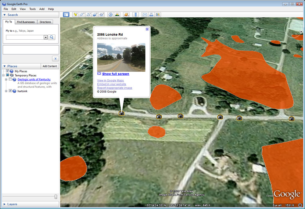
SINKHOLES WITH STREET VIEW LINKS
Adding Google Earth Street View, one of the default layers available in Google Earth, to the sinkhole data described above adds an interesting capability. Google Street View is offered in Google Earth and Google Maps, and provides panoramic views from rows of camera positions along streets. Camera positions can be displayed on the map and clicked to preview the roadside StreetView as you zoom closer. By choosing a camera location near the the sinkhole you want to view, you can take a virtual tour from the road. See the example below for the detailed Street View.
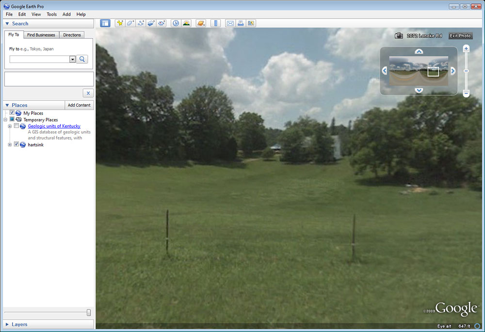
GOOGLE EARTH STREET VIEW OF SINKHOLES
Google Street View offers roadside viewing of the sinkhole data described above. Street View displayed at the top of the Street View window can be used to control the camera and pivot the view in different directions. The Street View can also be advanced along the roadway. Here we can see one of the sinkholes alongside the road. Street View can also be viewed in ArcGIS Explorer, and using ArcGIS Explorer can be combined with other layers and imagery such Bing Bird's Eye views.